


Garmin Montana 760i GPS Navigator
Add an item to your cart to get your MyMoto discount
Item is in stockHurry! Low inventoryItem is out of stock
Item is unavailable
RUGGED GPS TOUCHSCREEN NAVIGATOR WITH inREACH® TECHNOLOGY AND 8-MEGAPIXEL CAMERA
Get advanced outdoor features, inReach satellite technology for two-way messaging and interactive SOS alerts plus a built-in camera — all housed in a rugged 5-inch format ideal for navigation on foot, bike, kayak, ATV and more.
Features:
- Navigate easily with a display that’s designed to work even when wearing gloves.
- Explore with detailed, routable maps featuring landmarks, terrain, and more.
- Use inReach messaging for two-way communication and activate an SOS with professional emergency response support.
- Capture your adventure with an integrated camera that geotags photos, so you can revisit the exact locations.
- Designed to withstand extreme conditions, this device meets MIL-STD 810 standards for thermal, shock, water, and vibration resistance.
- Access vivid satellite imagery showing detailed overhead views of your route for enhanced navigation.
WHAT YOU'LL LOVE
-
Global Connectivity
Stay connected off-grid with an active inReach subscription. Messages, SOS, and tracking are transmitted via the 100% global Iridium® satellite network, bypassing the need for cellular coverage. -
Built-In Camera
Document your adventures with the Montana 760i’s 8-megapixel autofocus camera. Geotagged photos allow you to navigate back to favourite sites in the future. -
Rugged by Design
Built to endure extreme conditions, this water-resistant handheld meets MIL-STD 810 standards for thermal, shock, water, and vibration. Its glove-friendly 5-inch touchscreen and compatibility with robust mounting solutions (sold separately) make it adaptable to your activities. -
TopoActive Maps
Explore with preloaded worldwide topographical maps featuring terrain contours, elevations, coastlines, rivers, and landmarks. -
Satellite Views
Download high-resolution satellite imagery directly to your device over Wi-Fi®. Enjoy photorealistic overhead views of routes and terrain for precise navigation and waypoint creation. -
Outdoor Maps+
Upgrade with a subscription to Outdoor Maps+ (sold separately) for premium mapping content and regular updates, delivered via Wi-Fi technology.
inREACH FEATURES
-
Two-Way Messaging
Exchange text messages with loved ones back home, or communicate device-to-device with other inReach users in the field. - Interactive SOS In case of emergency, trigger an interactive SOS message to Garmin ResponseSM, a 24/7 emergency response coordination centre.
-
inReach Weather
Receive detailed weather forecasts directly to your Montana handheld or paired devices, so you’re prepared en route. -
Live Tracking
Share your journey with followers on a live tracking page. They can see your progress, ping your device to view your location, and exchange messages during your trip.¹
NAVIGATION FEATURES
-
Garmin Explore™ App
Plan and review your trips, manage waypoints, courses, and activities by pairing with the Garmin Explore app. -
Multi-GNSS Support
Access both GPS and Galileo satellite networks for more reliable tracking in challenging environments. -
ABC Sensors
Use altimeter, barometer, and a 3-axis electronic compass for advanced navigation on your next trail. -
City Navigator® Maps
Effortlessly switch from trails to roads with preloaded City Navigator street mapping, providing turn-by-turn driving directions. -
Additional Maps
Expand your map library with 32 GB of onboard memory. Download extra maps, like BlueChart® g3 charts for marine navigation (sold separately). -
Active Weather
Get up-to-date weather forecasts via the Garmin Connect™ app on your compatible smartphone. -
Dog Tracking
Sync with compatible Astro® or Alpha® handhelds to track sporting dogs during hunting or training activities. -
Wikiloc Trails
Access preloaded trails from Wikiloc, including hiking, cycling, and other outdoor routes. A free 60-day Wikiloc Premium trial is included for exclusive features.
ADVENTURE FEATURES
-
Public Land Boundaries
Display federal public land boundaries on topographic maps to ensure you're staying within legal areas. -
Expedition Mode
Use Expedition Mode to extend tracking for over two weeks on a single charge with an ultralow-powered GPS reference. -
Battery Options
Enjoy up to 24 hours of GPS mode battery life with a rechargeable lithium-ion battery pack, charging via USB-C®. -
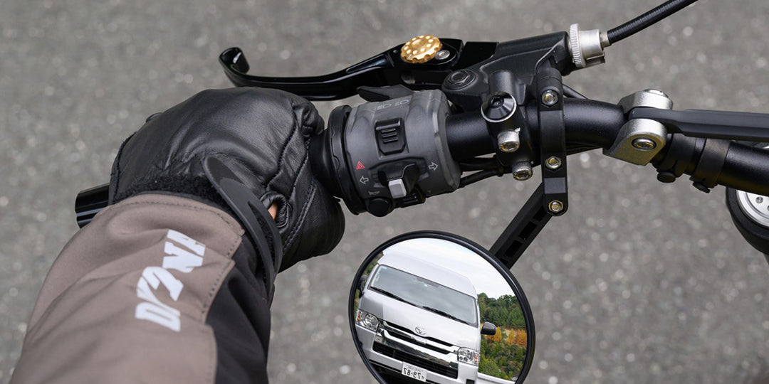
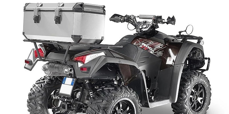
Vehicle Mounts
Use compatible vehicle mounts (sold separately) to adapt your Montana handheld for ATVs, boats, cars, motorcycles, RVs, or other vehicles.
Compatible Products:
- Outdoor Maps+ Annual Plan
- Bicycle Handlebar Mount
- Suction Cup Mount with Speaker